


Voting District 10095, Santa Cruz County, California
About
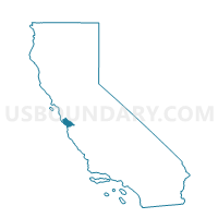
Outline

Summary
| Unique Area Identifier | 544054 |
| Name | Voting District 10095 |
| County | Santa Cruz County |
| State | California |
| Area (square miles) | 2.50 |
| Land Area (square miles) | 2.50 |
| Water Area (square miles) | 0.00 |
| % of Land Area | 100.00 |
| % of Water Area | 0.00 |
| Latitude of the Internal Point | 37.01737040 |
| Longtitude of the Internal Point | -122.01161720 |
Maps


Graphs
Select a template below for downloading or customizing gragh for Voting District 10095, Santa Cruz County, California


Neighbors
Neighoring Voting District (by Name) Neighboring Voting District on the Map
- Voting District 10005, Santa Cruz County, CA
- Voting District 10100, Santa Cruz County, CA
- Voting District 10115, Santa Cruz County, CA
- Voting District 10120, Santa Cruz County, CA
- Voting District 10220, Santa Cruz County, CA
- Voting District 10255, Santa Cruz County, CA
- Voting District 10270, Santa Cruz County, CA
- Voting District 51365, Santa Cruz County, CA
- Voting District 51560, Santa Cruz County, CA
Top 10 Neighboring County Subdivision (by Population) Neighboring County Subdivision on the Map
Top 10 Neighboring Place (by Population) Neighboring Place on the Map
Top 10 Neighboring Elementary School District (by Population) Neighboring Elementary School District on the Map
- Santa Cruz City Elementary School District, CA (62,259)
- Happy Valley Elementary School District, CA (1,399)
Top 10 Neighboring Secondary School District (by Population) Neighboring Secondary School District on the Map
Top 10 Neighboring Unified School District (by Population) Neighboring Unified School District on the Map
Top 10 Neighboring State Legislative District Lower Chamber (by Population) Neighboring State Legislative District Lower Chamber on the Map
Top 10 Neighboring State Legislative District Upper Chamber (by Population) Neighboring State Legislative District Upper Chamber on the Map
Top 10 Neighboring 111th Congressional District (by Population) Neighboring 111th Congressional District on the Map
Top 10 Neighboring Census Tract (by Population) Neighboring Census Tract on the Map
- Census Tract 1212, Santa Cruz County, CA (6,114)
- Census Tract 1208, Santa Cruz County, CA (5,863)
- Census Tract 1001, Santa Cruz County, CA (2,163)